Transforming a former rail line — an important part of Poughkeepsie’s rich industrial history — into a new option for safe community access and transportation
Visit the Northside Line website for more info and updates
Transforming a former rail line — an important part of Poughkeepsie’s rich industrial history — into a new option for safe community access and transportation
Visit the Northside Line website for more info and updates
Built in 1873, this 2.7-mile wishbone-shaped rail spur was created as a link between east-west and north-south railroad lines intersecting in Poughkeepsie. Freight trains delivered raw materials to industries along it and transported their finished products to markets nationwide. They also delivered coal to the newly-completed Hudson River State Hospital.
After World War II, the need for this rail spur gradually declined as many industries in the city and town began moving to other parts of the country. In operation until the closure of the state hospital in the 1990s, it has remained unused ever since.
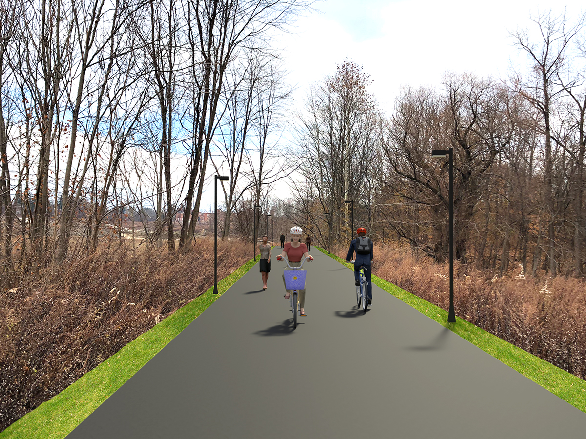
A new, 1.2-mile, multi-use path for pedestrians and cyclists is changing the face of Poughkeepsie by offering unprecedented access between residential and commercial neighborhoods in the city and the town. This new corridor — open 24 hours a day year round — now allows residents and visitors alike to bike and walk to work, school, local businesses, hospitals, and parks.
Stretching from the new Hudson Heritage Plaza in the town, to Parker Avenue in the city, the trail serves as an important link for the city’s Northside neighborhoods where many households face economic challenges and may not have access to a vehicle. The path is lit and under 24-hour video monitoring.
Recognizing its potential to link not only disparate neighborhoods, but Marist College and the MidHudson Regional Hospital as well, Scenic Hudson negotiated and funded the acquisition of the former rail corridor in 2019. The following year, the Dutchess County Legislature voted unanimously to assume ownership of the corridor and to develop and maintain a new rail trail, which was named the Marcus J. Molinaro Northside Line in 2023.
The MJM Northside Line will continue to offer safe, convenient access between the city’s Northside and the town’s northern neighborhoods. It also provides a car-free option to walk or bike to work, school, shops, medical facilities, and public parks. People living directly adjacent to the trail stand to benefit the most from this new green infrastructure. With the potential to bring new people to different areas of the city, the MJM Northside Line could create economic opportunities for Poughkeepsie.
Dutchess County is leading the overall project, from preliminary design and permitting to final construction. Project partner Scenic Hudson enabled the project by purchasing the former rail lines. Hudson Valley Engineering Associates (HVEA) of Beacon is the design engineer of the new trail system and is assisting the county with necessary environmental permitting. Susan G. Blickstein, LLC is assisting HVEA, Inc. in community outreach and engagement.
The southernmost terminus of the proposed trail begins on N. Hamilton Street in the City of Poughkeepsie and travels north. After crossing the Dutchess Rail Trail, it continues through the city’s Northside and past the Mid Hudson Regional Hospital. In the town, the trail runs through Fox Run at Fulton before ending at Hudson Heritage. Another spur of the trail begins on Fulton Street, heads southwest past Marist College, and ends near Kittredge Place, not far from the Hudson River.
The Northside Line will also link over a dozen community assets, providing a new way to access them and supporting their programs and activities. These include Morse and Warring Elementary Schools, the Family Partnership Center, Beulah Baptist Church, the Dutchess County Mental Health Campus, Walkway Over the Hudson, Fall Kill Creek, Morgan Lake, and Quiet Cove Riverfront, Pulaski, Mansion Square, and College Hill Parks.
The first portion of the trail is now open for public use. It includes a 1.2-mile segment with a multi-use, non-motorized path for pedestrians and bicyclists from the new Hudson Heritage Plaza in the Town of Poughkeepsie to Parker Avenue (State Route 9G) in the City of Poughkeepsie. For more updates visit: https://www.dutchesscountyurbantrail.com/news-updates
The safety of the Northside Line is a key component of the design. It will have two cross-sections: the majority will be a split-use trail — with divided zones for pedestrians and bicyclists — and the rest will be shared-use trail. Where constraints limit trail width, or when usage is expected to be lighter, a shared-use approach is proposed. There will be lighting and signage throughout the new trail network. In addition, ongoing discussions with emergency first responders who will serve the trail, and their feedback, will be crucial in drafting and implementing the project’s final design.
Public participation in determining the design and future uses of the trail is vitally important. The design phase of the project began with an online community survey and virtual meetings to receive community input. Comments are already informing next steps. As future opportunities for input are planned, community questions and comments are welcome at urbantrailproject@dutchessny.gov. To learn more visit https://www.dutchesscountyurbantrail.com.
Dutchess County acknowledges the potential for gentrification and associated risk of rising property values. While this is not a residential project and we don’t have direct control over housing affordability, the county is actively working with Scenic Hudson, Hudson River Housing, and the Poughkeepsie Affordable Housing Coalition to implement policy and provide resources to combat drastic rent hikes and displacement, especially in the city’s Northside neighborhoods.
We foresee attracting traffic to local businesses from trail users. The Northside Line is also collaborating with Northside Junction on street improvements that may include new crosswalks, landscaping, and traffic-calming measures. We also will make every effort to employ local businesses in the trail’s construction.
It’s possible, but very unlikely. The property was previously owned by CSX and was acquired via the federal railbanking process, which allows a railroad and trail agency to collaborate on the use of out-of-service corridors until a railroad might again need it for service. Of the hundreds of rail trails created nationwide since the program began in 1983, very few have been reactivated for rail use.
Yes, the trail features lighting and is monitored by security cameras and law enforcement patrols to enable safe, 24-hour use. It will also be plowed during the winter months as needed. Other amenities include secure bike parking, bench seating, and bike-repair stations.
Updates/Events/More